‹BACK TO MAP
21 Mar 2025
Satellite detected water extents between 15 and 19 March 2025 over South Sudan
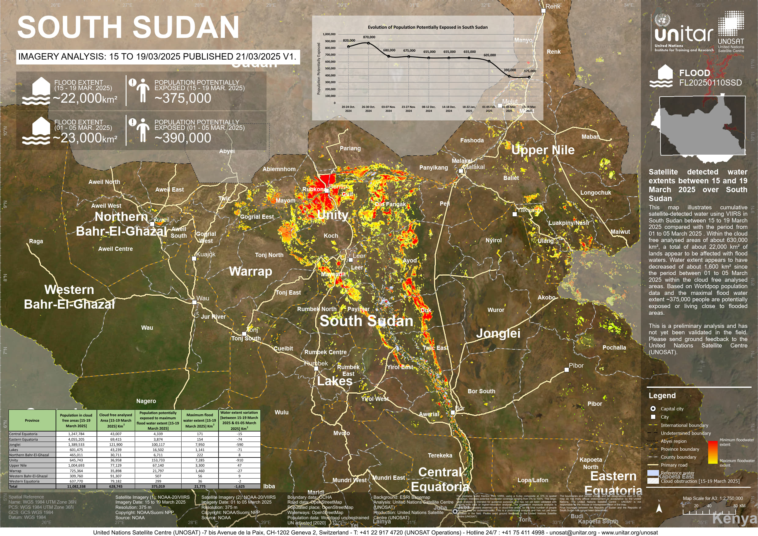
This map illustrates cumulative satellite-detected water using VIIRS in South Sudan between 15 to 19 March 2025 compared with the period from 01 to 05 March 2025 . Within the cloud free analysed areas of about 630,000 km², a total of about 22,000 km² of lands appear to be affected with flood waters. Water extent appears to have decreased of about 1,600 km² since the period between 01 to 05 March 2025 within the cloud free analysed areas. Based on Worldpop population data and the maximal flood water extent ~375,000 people are potentially exposed or living close to flooded areas. This is a preliminary analysis and has not yet been validated in the field. Please send ground feedback to the United Nations Satellite Centre (UNOSAT).
PRODUCT ID:4090
PUBLISHED:21 Mar 2025
GLIDE:FL20250110SSD
Analysis: United Nations Satellite Centre (UNOSAT)
UNOSAT 2024Terms of Use